The Lafitte Greenway, canal line to bayou
A paved path runs for about two and a half miles from the edge of the French Quarter through Tremé and Mid-City to Bayou St. John, following the line of an old canal and railway.
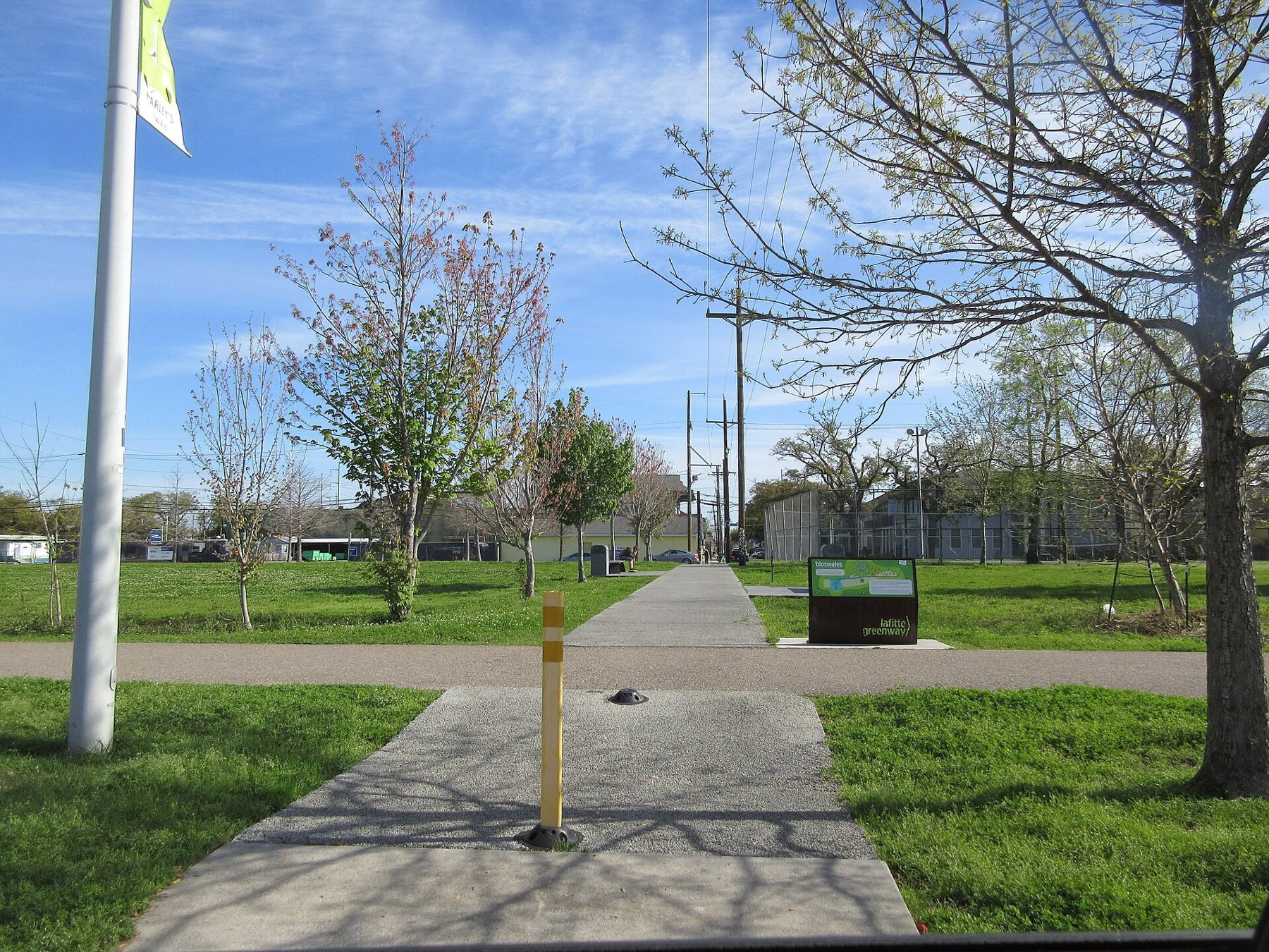
The Lafitte Greenway is a walking and cycling path that cuts across the city from near the French Quarter to Bayou St. John, a distance of about two and a half miles. It opened in 2015 on a corridor that has been a transport route for more than two centuries: first a canal, then a railway. Today it is a green ribbon of trees, lawns, playgrounds and sports fields, used by commuters, joggers, dog walkers and families.
From canal to greenway
In the late eighteenth century, during the Spanish colonial period, the Carondelet Canal was dug from the back of the old city toward Bayou St. John, giving boats a route from the lake to the edge of town. The canal turning basin lay close to what is now Basin Street. Later, the canal was filled and a railway used the corridor, and after the trains stopped, the land lay neglected for decades. Community campaigns turned it into the greenway.
The route, stage by stage
The greenway starts near Basin Street and Louis Armstrong Park, on the edge of the French Quarter and Tremé, and runs northwest through Tremé and Mid-City to Bayou St. John near the end of Canal Boulevard. The path is paved and flat, with separate lanes in places. It crosses several busy streets, some with signals; take care at every crossing.
Shade and heat
Trees have been planted along the greenway, but many are still young, and much of the path is in the open. In summer, the middle of the day can be very hot. Ride or walk early in the morning or in the evening, and carry water. In the cooler months, the greenway is pleasant at any time.
Neighbourhoods along the way
The greenway passes through some of the city's historic neighbourhoods. Tremé, near its southern end, is one of the oldest African American neighbourhoods in the United States, with a rich history of music and community life. Mid-City, further along, is a mix of homes, businesses and old industrial buildings. Detours off the path lead to local streets and landmarks; respect residents' privacy.
Cycling and connections
The greenway is part of a growing network of bike lanes in New Orleans. From its ends, routes lead toward the French Quarter, City Park and the lakefront. Bike-share stations exist in parts of the city; this guide names no services. Lock bicycles securely.
Staying safe on the path
- Use lights and reflective clothing after dark, and choose busy times.
- Watch for traffic at street crossings, where drivers may not expect cyclists.
- Keep belongings secure, as in any city.
- Carry water; fountains are few.
Along the path
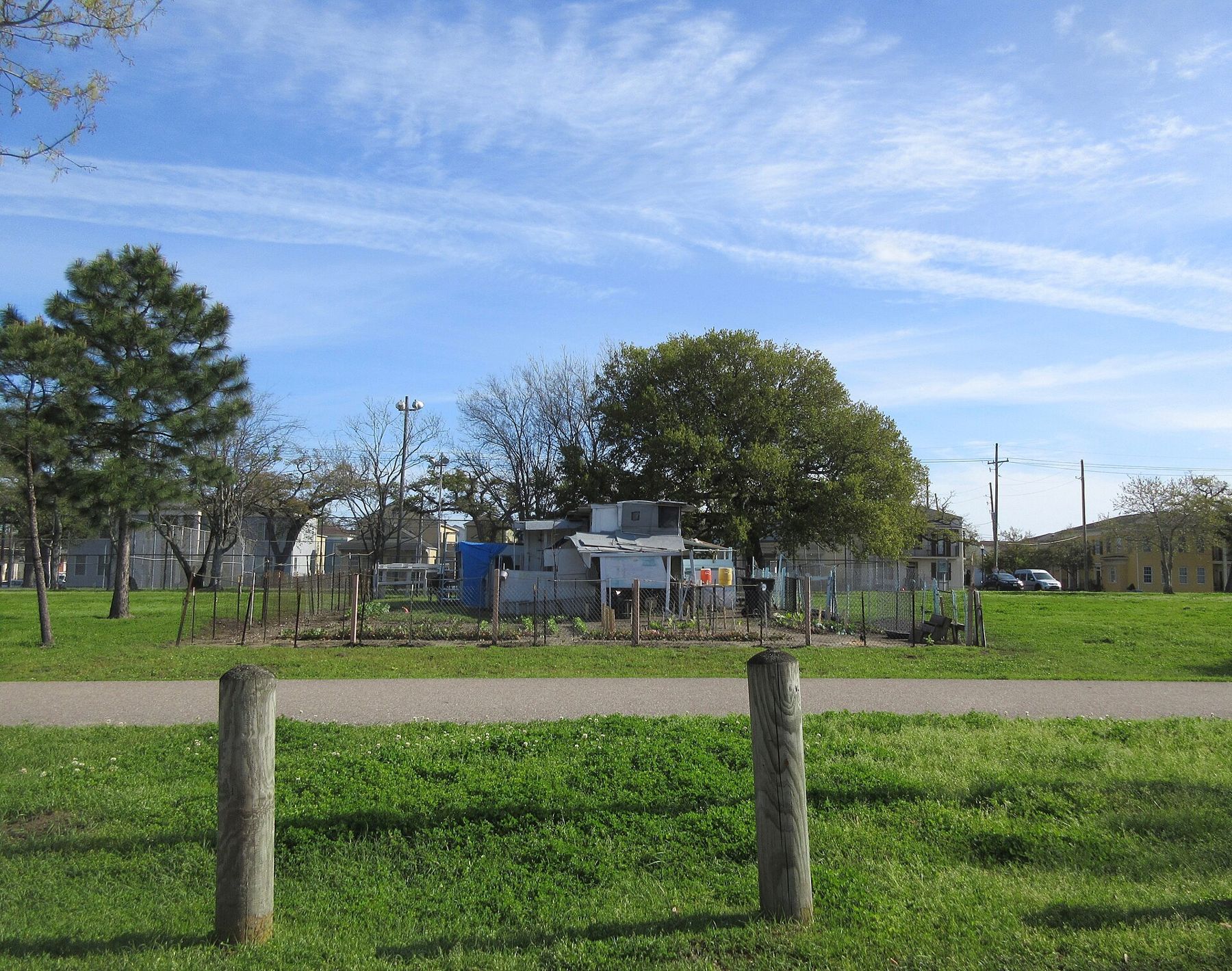
Another panel · Side gatesLouis Armstrong Park and Congo SquareAn hourThe greenway is more than a path. Along its length, small parks, playgrounds, sports fields and community gardens have been created on the old corridor. Native plants and trees line parts of the route, chosen to cope with heat and heavy rain and to soak up water during storms. Murals and public art appear on nearby walls. On weekends, local events and markets sometimes take place along the way.
Water and design
Like many new green spaces in New Orleans, the greenway is designed to help manage rainwater. Low areas, swales and plantings collect water during heavy rain and let it soak away slowly, easing pressure on the drains. After a summer downpour, you may see pools in these areas; they are meant to be there. It is a small example of the city learning to live with water rather than only pumping it away.
Combining with the bayou
A good half-day outing is to walk or cycle the greenway from the French Quarter end to Bayou St. John, follow the bayou north to City Park, and return by the Canal Street streetcar. The route covers some of the city's most interesting neighbourhoods and green spaces, with options to stop for food and shade along the way.
Tremé and the music
Near its southern end, the greenway passes through Tremé, a neighbourhood closely tied to the history of New Orleans music, from brass bands to jazz. Second-line parades, when social clubs march through the streets with brass bands on Sundays in the parade season, sometimes pass nearby. If you meet one, you are welcome to follow along on the sidewalk, enjoying the music and dancing, while staying out of the way of the club members and the band.
The neighbourhood has churches, community halls and corner bars that have been part of its life for generations. Treat it as a home, not a stage.
For a first visit, start at the southern end near Armstrong Park in the morning, walk or ride toward the bayou with the sun behind you, and plan a break in one of the small parks along the way.
Food and rest stops
The neighbourhoods around the greenway have small cafés, corner stores and places to eat, though this guide names none. The path itself has benches and some shade structures. On a hot day, plan short legs with stops, and carry more water than you think you will need.
When the shade allows
Autumn, winter and spring are the most comfortable seasons. Early mornings are quiet and cool, and the light is soft. Weekends bring more families and sports activity in the fields along the path.
At the southern end, visit Louis Armstrong Park and Congo Square. At the northern end, continue along Bayou St. John toward City Park.